
Blunder and/or GPS site unusable?
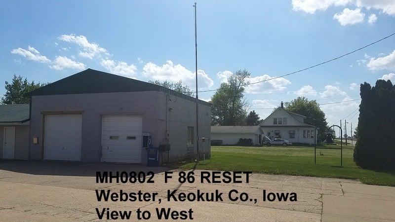
Yesterday I did a 6-hour OPUS session on a disk that has poor sky visibility, but is on the NGS priority list for GPSonBM because there is nothing else found with decent sky for some distance. I wanted to find out how bad the results would be, and indeed they are bad.
The rapid-orbit result using Geoid12B is 0.288 meter (0.945 ft) higher than the leveled elevation.
Only 83% ambiguities fixed, EL HGT pk-pk = 75 mm showing that it isn??t a very stable measurement. I had a similar ultra-rapid solution and one (expecting rapid to be available) that was even higher. I??ll re-run the solution again when precise orbits are available, but don??t see it as likely that will make much improvement in matching up.
I have done a session 30 km (20 miles) away and came out 45 mm lower than the leveled elevation, not unusual for the fit of Geoid12B, so I don??t think the geoid could be so far off at this new session as to explain most of a foot discrepancy.
I broke it into 3 files of 2 hours each and got these differences from leveled: +305, +226, +252 mm (0.74 to 1.00 ft, giving a different average). Not great repeatability.
This mark is a RESET done by a local surveyor in 1980 and is rather far for a reset, almost a quarter mile from the original that was on a school building that was torn down. If I hypothesize a 1-foot blunder in his readings or calculations, I would be 17 mm lower than leveled (2-hour sessions 0 mm, 79 mm, and 53 mm lower than leveled). Those values would seem reasonable for a poor site. I still wouldn’t want NGS to use my measurement to constrain their new geoid.
So the questions are:
- Does this environment explain such a huge difference, or did the guy doing the reset make a 1-ft blunder?
- Should I go ahead and share my solution when precise orbits are available, or does this environment invalidate any possible GPS solution?

Log in to reply.