
Activity Feed › Discussion Forums › GNSS & Geodesy › NGS reply to question of offset GPS obs to vertically-set BMs
NGS reply to question of offset GPS obs to vertically-set BMs
Posted by geeoddmike on May 5, 2021 at 6:51 pmFrom the 2021 Geospatial Summit
Q:
A number of surveyors have expressed dismay at their inability to include offset GPS observations to benchmarks set in the sides of buildings, etc. They are willing to run levels to their antenna site but find no way to submit such observations. Is there a solution?
A:
There is a solution, but it involves setting a new permanent mark nearby, which is not convenient. Anyone is welcome to follow the Bench Mark Reset Procedures to achieve a GPSonBM for the situation you describe. Here is a link to that Procedures document:northernsurveyor replied 2 years, 11 months ago 8 Members · 8 Replies- 8 Replies

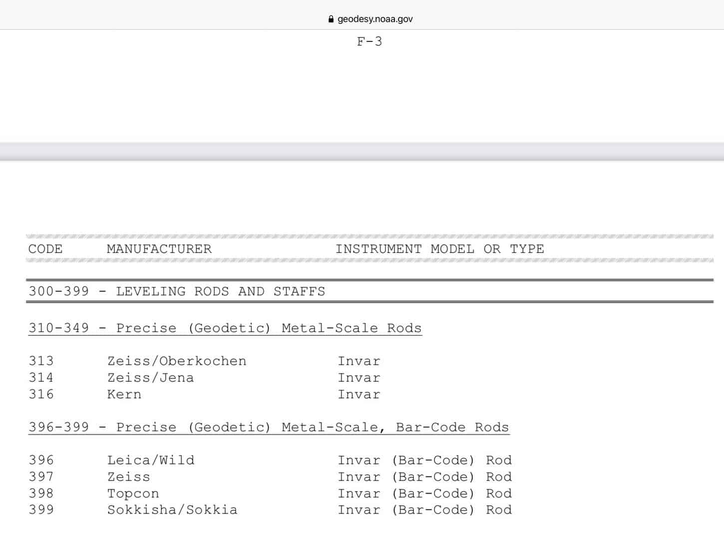
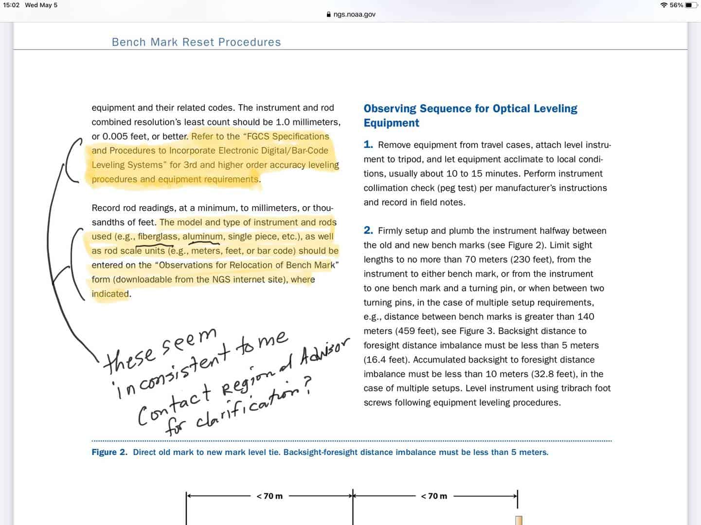
That is unfortunate because based on my experiences, NGS requires the use of a single piece rod to comply with the cited FGCS specifications:
Please note the reference to the ??FGCS Specifications and Procedures to Incorporate Electronic Digital/Bar Code Leveling Systems? for 3rd and higher order accuracy leveling requirements on the bottom left side of page 3 of the NGS document. By reference to the FGCS specifications, a one-piece leveling rod is required to be in compliance with NGS procedures. Citation of this rod requirement can be found near the bottom of page 2 of the FGCS document.
This, essentially by default, requires the use of an invar rod, which many of the people wanting to contribute to the GPS on BM campaign will not have. Therefore, requiring a BM Reset to do an offset observation essentially is a deal killer.

That’s been their answer for some time now. I make myself obnoxious by raising the issue at every relevant presentation.
My argument is that all they have to do is put a check box in the OPUS Share screen to disregard the precise horizontal values for an offset measurement and just use the vertical. The geoid isn’t going to change measurably in the offset distance.
I argue that anybody doing OPUS sessions, and hoping for 1 cm accuracy at best, and trusted to measure up to the ARP to the millimeter, is also qualified to do one turn of a level (with repeated setups) with similar accuracy.
The benefit would be the opportunity to fill a LOT of their hexagons where there are no found, stable, and open-sky marks but lots of vertically mounted marks, marks under trees, or too close to a railroad where you might be able to risk a quick level turn but not leave a GPS setup all afternoon.
Their target list has numerous problems: marks that have been repeatedly reported as Not Found, sometimes vertically mounted ones, and many that turn out to not have sufficient sky.
.
The “All or Nothing” approach.
Nice.
Surveyors will never understand, as we understand that “Good Enough” is just as good as “Perfect” in the real world, and costs a lot less. But, if we had taxpayers footing the bill we might tend to be “All or Nothing” as well.
-All thoughts my own, except my typos and when I am wrong.
I understand the frustration, and agree that a less-stringent procedure could produce valuable results, but I also appreciate the fact that any process that accepts observation data from entities beyond the control of NGS has to include a way to ensure data quality. Even the seemingly modest task of devising, documenting and implementing an alternative procedure requires staff resources that are already stretched thin. It’s not surprising to me that NGS has chosen to rely on an established protocol in this regard.

It’s an expensive solution.

This definitely cements the 100k dollar NASA prize as never attainable.
????

Rather than the FCGS document, I??d refer to:
https://www.ngs.noaa.gov/PUBS_LIB/Benchmark_4_1_2011.pdf
screen captures from that document and Annex F follow:


I thought that was one of the most interesting questions today. I concur with the poster of the question. There are so many valuable Benchmarks that simply cannot be occupied with GPS that are set vertically in buildings, bridge abutments, etc. Common private practice to use these marks to control surveys vertically is set a nearby eccentric point with good Satellite visibility, and make a one turn spirit/digital level difference (verified by double measure) and use that eccentric point as a vertical constraint in their network. NGS having the posture that the only way to accept GPS observations on such benchmarks is to go through a full Benchmark Reset process is draconian and not financially sensible for those that simply want to contribute valuable GPS data on existing benchmarks. In my opinion NGS response slipped them back to the NGS “there is only one way to do this, the archaic way we have a manual or procedure for”. Its their call, but they eliminated a lot of good contribution for this seemingly arbitrary ruling, which has the appearance that they cannot trust a private party to do a one turn leveling between points a few meters apart.


Log in to reply.