
Activity Feed › Discussion Forums › GNSS & Geodesy › Why are there some errors and inaccuracies in the transformation between geodetic systems?
Why are there some errors and inaccuracies in the transformation between geodetic systems?
Posted by ASIGT on March 14, 2021 at 6:36 pmHi everyone,
I want to know the reason why the transformation between geodetic systems might result in some inaccuracies and how I can minimize them.
Thank you.
geeoddmike replied 3 years, 1 month ago 6 Members · 6 Replies- 6 Replies

A more specific question might get a better answer. What systems for example, what tools doing the transformation, and inaccuracies measured against what?
.
In an unchanging world with perfect data and modeling maybe you could approach your goal. More so over a small area.
For information about how and why at the highest levels such transformations are created.
See:
https://www.iers.org/IERS/EN/DataProducts/ITRF/itrf.html
As for as ??inaccuracies? consider the magnitudes of the changes shown below:
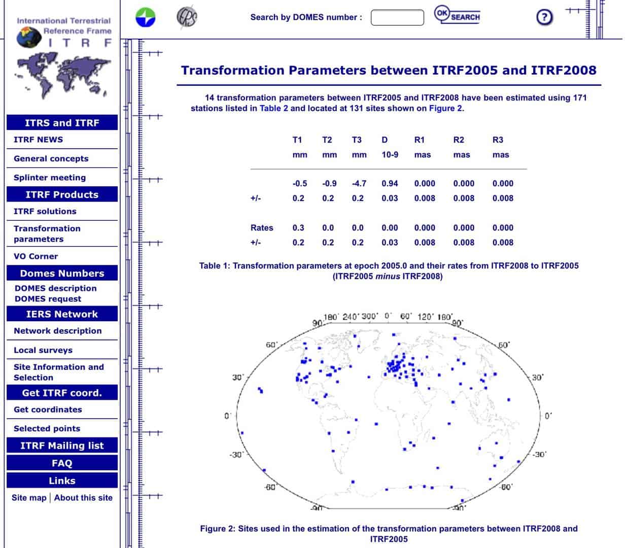

Each successive realization includes measurements that were not yet made when the previous realization was computed, and reweights or excludes altogether outlier measurements that were used. Different input data means shifts that are not uniform throughout the network.

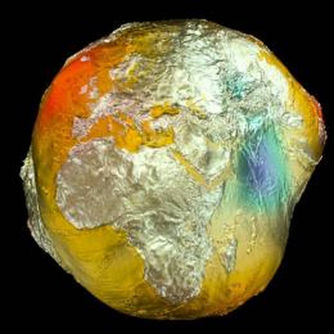
This kind of sums it up….the earth with no water looks like this….
This is the abridged reader digest clipped paragraph version to be sure…

The way to deal with them is to survey. If you are wanting NAD27 values, find NAD27 monuments, occupy them and do your survey. Same with other realizations. Same as its always been. Even if your occpation is a file from a CORS.
Points in the NGS database having NAD27 positions will have those positions shown in the ??Superseded? section of the point??s datasheet.
Trying to derive an NAD27 position from an NAD83 (or vice-versa) for points not in the NGS database is more challenging. Remember too that there are many versions of NAD83. The best approach is to compute a position using observed values with the originating station in the coordinate system you want the positioned station to be in.
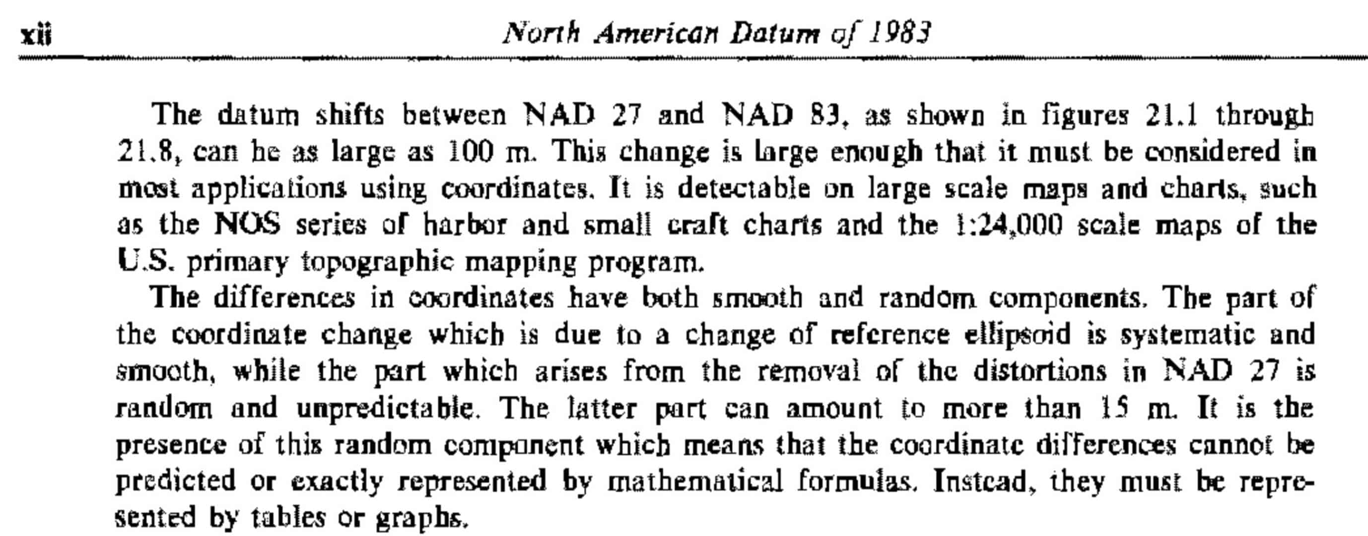
The OP mentions using transformations rather than recomputation. He does not specify which systems he wishes to transform between. IF it is NAD27 to/from NAD83(whatever variant), he has a problem as the NAD27 system has significant problems. For a complete and thorough explanation see NOAA Professional Paper 2. I provide this screen capture illustrating my point.
For the paper see: https://geodesy.noaa.gov/library/pdfs/NOAA_PP_NOS_0002.pdf
If the OP is interested in generating his own transformation parameters he might want to examine the following paper and its references:
https://www.sciencedirect.com/science/article/pii/S0377042705006862
For transformations in the US, the NGS has developed the following: https://geodesy.noaa.gov/NCAT/
Hope this contributes,
DMM


Log in to reply.