
Adventures in GIS and self-teaching
Following some recent threads on GIS and finding data sheets for city survey monuments, I decided to revisit GIS and see what I could learn. Don’t be too critical; this is the result of about 5 days, off and on, work.
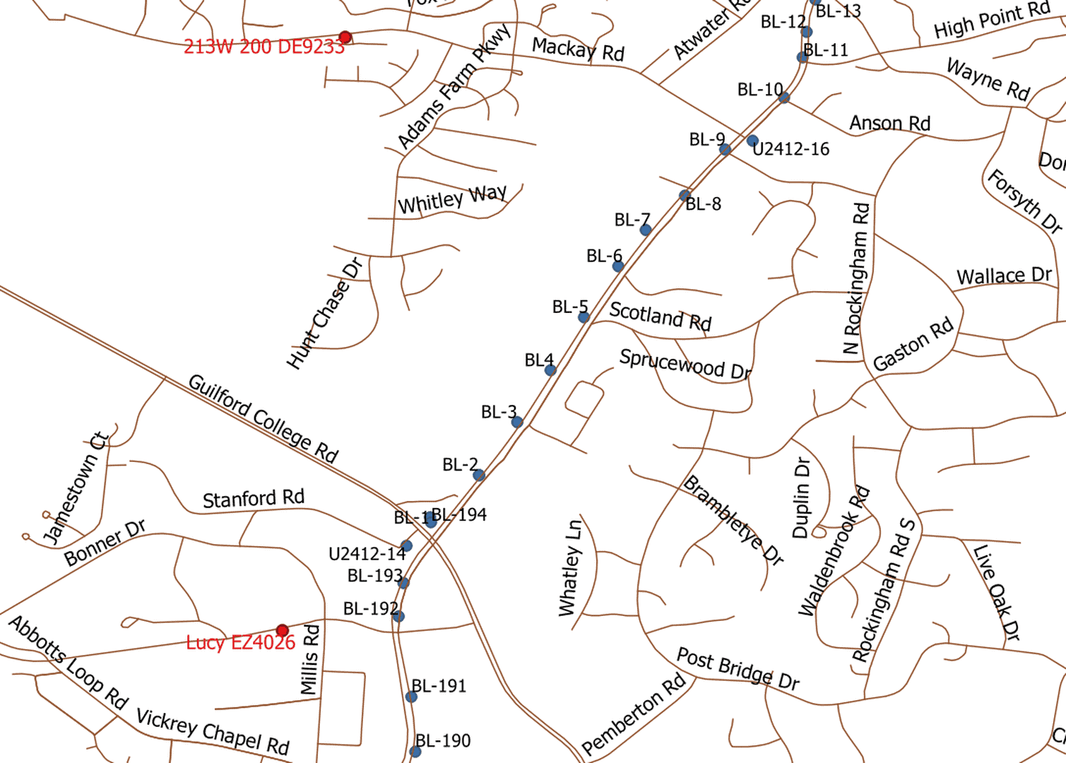
This map portion is in QGIS. I downloaded the open source software, used some internet searches and some old shapefile data I had developed earlier in DNRGPS.
What it shows is a portion of the completed part of three NCDOT projects in Guilford County, NC. The base map that shows roads is a Tiger file from the Census Bureau. The BL points are from a public NCDOT project file, converted from text to .shp in DNRGPS. There are two NGS marks which appear in red. The basemap, the BL points, and the NGS points are each in separate layers.
There’s a lot left to learn. The basemap system is EPSG:4269 while the other two layers are in EPSG:2264. The coordinates for the NGS marks are a couple of feet different from the NGS datasheets and there’s some question in my mind about the ellipsoid(s) used. While the map looks good, plane coordinates taken from it would not be advisable.
So, with some minimal background, enough details can be figured out to produce a reasonably representative map. The BL points generally follow the completed road and the project begin and end points (near the Guilford College Road intersection) are in the right area. Inexperience and sketchy knowledge, though, are not a good combination for exact work and that’s where the danger lies.
Pretty good entertainment for a math nerd, but real work needs to be in better hands.


Log in to reply.