
Activity Feed › Discussion Forums › Software, CAD & Mapping › Where Are These Monuments Again?
Where Are These Monuments Again?
Posted by jhframe on August 19, 2022 at 3:18 pmI’m okay with exaggerating the scale on map details, but there ought to be *some* semblance of reality to it.
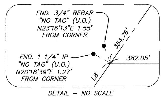
(North is up the page, and L8 has a bearing of N34?ø56’56’E.)
jhframe replied 1 year, 8 months ago 9 Members · 16 Replies- 16 Replies


I’ve seen examples like this where people that don’t understand local vs. SPC, geodesy, GNSS, etc. and they scale the linework from ground to grid (or grid to ground). The points remain hooked to the original coordinate system and the linework changes. Quick inspection could indicate scaling linework down in this case, and then moving the linework to hold the “best” monument? Not sure why or how, but maybe?

At a standard survey/engineering drawing scale, those distances are still so small that it’s far cleaner to not even try to show them graphically. Given that they are not being held and don’t appear to be reference monuments from which the PI/intersection was calculated, showing their orientation graphically is irrelevant.
A single leader with single text box, on the face of the main drawing, describing both objects would work equally well. Then again I really try to avoid details unless they are absolutely necessary. I’d rather add a sheet or two, especially now that everything is digital, than end up with a bunch of details that viewers have to jump back and forth between.
(What does “U.O.” mean, by the way?)
“…people will come to love their oppression, to adore the technologies that undo their capacities to think.” -Neil Postman
I’m OK with the scaling but I find the angular distortion is confusing. I think that I would have left off the 354.76 and 382.05 calls and put line bearings in their place. Still, it is better than nothing. Never let the perfect be the enemy of the good.

At least get the graphics in the correct quadrants. It’s just not that hard to do.

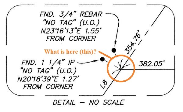
I’m curious why the 1-1/4″ IP was not just held. The two points are on top of each other almost.
Pretty poor detail none the less .
@gary_g
why the pipe and not the IR?
Just guessing the pipe is older than the rebar. That’s all.
- Posted by: @gary_g
Just guessing the pipe is older than the rebar. That’s all.
That’s the point. Either choice would be a guess.

UO usually means ‘I didn’t look for, ask about, or put in any effort related to this monument’ ..

@norman-oklahoma
Sorry to confuse the post. Either way the detail sucks.
 Posted by: @flga-2-2
If you go out there the is two lines drawn on the ground with annotation leaders painted, pretty obvious really.
Damn, I missed that. Good thing I retired. ????
- Posted by: @thebionicman
UO usually means ‘I didn’t look for, ask about, or put in any effort related to this monument’ ..
In this case that doesn’t pertain — the firm that did this survey is generally quite reliable, and has records going back to the early days of the counties in which they usually work. (Often more complete records than the county governments.)
My gripe isn’t with the survey, it’s with the drafting. The two monuments are called out of position because there was plenty of other monumentation nearby defining the street centerlines and lot lines. These two are outliers that poke into the RR ROW and don’t line up with the street ROW line by over a foot. I’ll probably treat them the same way (haven’t done the field work yet).

Log in to reply.