
Activity Feed › Discussion Forums › Strictly Surveying › Calibration Baselines…how many go regularly?
Calibration Baselines…how many go regularly?
Posted by john-hamilton on May 2, 2022 at 7:14 pmWe go to a CBL once a year, in the spring. More recently it has been a requirement in our scope of work, but we had been going annually before that. Last year I went to the NGS Corbin baseline (5 hours away) because I had my doubts about one that we use in Ohio that is about 3 hours away, as it is located at the base of a large earth dam. It is nice to use because they keep it mowed and it consists of pillars (no tripods, no centering errors). This year we are going to one that is 2 hours away at a small airport. There is one closer but I believe someone told me it is no longer intact (missing stations).
I use calibrat.exe (dos program form NGS) to process the data (i.e. to determine the constant offset and ppm).
I know a few surveyors who never go, others that do somewhat regularly.
I think in some states it might be a requirement in the standards and specifications?
geeoddmike replied 11 months, 1 week ago 25 Members · 59 Replies- 59 Replies

I haven’t been to a CBL in a long, long time. There are a couple around here that are supposedly in good condition, all at airports where access can be a pain.
Our instruments typically get their EDMs calibrated during their annual service. A full service shop should have an “infinity” electronic baseline setup that can determine the values in the shop.
I would probably want to verify those values if I were doing as much deformation work as @john-hamilton, but our high-precision work is pretty minimal these days.
“…people will come to love their oppression, to adore the technologies that undo their capacities to think.” -Neil Postman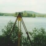
Two of the calibration base lines in my state that are close enough are now inaccessible. One, at an airport has the first and last point useless because of an improvement project. They made a bunker that obscures the end point and a hole where the first point is. Clever.
The second is in the median of a highway and due to the fact that everyone with a cellular phone uses it to report some kind of terrorist activities when surveyors attempt to use it, has become useless. I have been told, with enough cones to delineate the 1300 meters of base line and a State Police detail, I can work there. Can you say budget buster?
With those two out of the picture, I would say it would take most of the day just to get to the others, and being a stranger in town, I don’t know if I would want to risk it.
Historic Boundaries and Conservation Efforts
I have two CBLs in the southern half of the state. Both are not worth going to, on is at an airport with limited access and the other is too close to the road to safely park.
We have six Leica guns in service and a spare. All the guns, including the spare are sent in for cleaning and calibration once a year, on a rotating schedule and we get a yearly calibration certificate for each to keep in our files.
The state requires it, but, they never check on it. It’s the same with continuing education, it’s required, I comply but nobody, since I was licensed in 1993 has ever asked to see my CEU certificates.

I understand about the yearly dealer clean/calibrate. Probably what most do nowadays. I wonder how accurate their method is. I believe my dealer told me one time that they shoot an actual line across the river to a prism mounted on a building on the other side. But of course there is always the issue of buildings moving/expanding/contracting/settling, and what did they use to establish the line in the first place?
When I went on a tour of the Trimble factory in Sweden years ago (former Geodimeter factory) they had a window that they opened and shot to a distant prism on a building, and they said that they tested every S6 that way before they shipped.
I take one instrument/prism combo to the CBL, and then bring it back to my office and use it to measure between the two pillars that I have, which are about 135 meters apart, and then check other instruments/prisms against that.

In response to Mr Hamilton??s post, I took a look at the NGS CBL page: https://www.ngs.noaa.gov/CBLINES/calibration.shtml
I had not realized that new policies and participation procedure documents had been implemented in 2021. Also there is a Windoze 32-bit program (Calibrate) available for reductions.
The page above has links to the various elements of the program as well as the related technical memoranda (NOS NGS TM 8 and 10).
NGS will cooperatively establish, verify or remeasure a Calibration Base Line (CBL). In the case of a new CBL the partner is responsible for finding a suitable site, set monuments, run levels between monuments, clear lines-of-sight and provide a support person for the actual measurements.
I did not see mention of a training class which was the case in the late 1990s. I took the class overseen by the late Charlie Glover. I worked with the state land surveying society to set one CBL and remeasure another CBL. NGS provided the specialized and calibrated equipment. While I have not noted much mention of the use of steel tapes, there are procedures allowing a 100 foot monument to be established as part of a CBL.
In closing, I once attended a state society CBL ??event? where attendees could check their EDMI. Unfortunately most chose to measure only one or two segments and if they agreed within their comfort level thought that was enough.

I ran the KELIM CBL once with our new at the time 0.5″ S9 HP we used for our precise structure/monitoring work we did,and yeah I’m a dork, I found that pretty cool. ????.
It’s always to see if YOU can perform at the instrument’s ability.

I don’t go as often as I should, especially as there are 3 of them in the Portland Metro area. But I do go more than anybody I know. Which is to say that I have actually been to it. On one occasion I went to the Hillsboro base and found that a highway sign had been erected smack in the middle of it 6-8 months prior. It took another 6 months to get the sign moved. So I know for a fact that nobody had used it for that period of time.
I once visited one north of Tulsa, OK. It was overgrown with 6 inch trees. It takes about 20 years for trees to get to be 6″ diameter in OK.

Prelude: I think most baselines that have a monument to check steel tapes have it set just under 100.000 feet so that every tape can be checked, especially ones that are made just shy of 100.000 feet, say, 99.975 feet between “0” and “100” on the tape.
A surveyor I met decades ago took his steel tapes to a baseline and thought otherwise: that the distance between 0+00 and 1+00 was exactly 100.000 feet. He used his “calibrated” tapes to do dozens of surveys before he was corrected. To his credit he filed a Record of Survey to cover every erroneous survey.

It??s interesting that there??s calibration baselines for checking total station distances, while many surveyors rely heavily on RTK (VRS/RTN even which has more error than local base RTK), where with RTK you can measure two points , then measure those points an hour later and observe a different distance between them compared to the first observation. Basically RTK (VRS is network RTK and has more error than local base RTK) is a variable distance measuring device. ????

@norman-oklahoma
I think the Hillsboro CBL could use some tender loving care. When I last visited it (in 2020) I noticed that one of the points had been hit by a mower or something. It is almost impossible to distinguish the punch mark on the monument. I like the idea of have monument pedestals at the points. I wonder if ODOT would let us place them that close to Hwy 26?

I drive by one nearly every weekday, but haven’t set up on it in years. I did park my work truck next to it a couple of times to let my dog run through the adjacent fields. 🙂
To me, centering error and bubble adjustment are way more important.
Error’s detected on a CBL are systematic and can be accounted for while those associated with GNSS (post processed and real-time) are random.
Of course this assumes a stable setup for both.

I have been discussing the baseless with my boss man. They too send instruments in for clean and calibration. But When I was out west in late 90??s we took every total station out to the baselines like clock work . I became very efficient at it. Doing 7 total stations twice a year as soon as they returned from clean and calibration was something that became a part of my routine. Now we rented a high end wild 1/2 ?? total station for the Henderson mine project. Took it to two different baselines because it was systematically reading the distance incorrectly. Then they finally fixed it at the shop. So its good to let the crews learn what is and how to prove the federally mandated weights and measure come from. If I were licensed it would not matter if my state requires it or not I would still take a day to run to a baseline and mentor the younger generation into learning this. Plus it really doesn??t take long but can make for a good day of one on one with an upcoming potential license person for the LS PLS to have a way to accomplish something and even get a little time with employees outside the daily grind. I remember jamming to the radio from the old f150 cracking jokes with the Party Chief and seeing who could set up the targets and instruments the fastest and double checking each other. Did steel tapes as well. That baseline holds more weight in my opinion than a manufacturer. Hopefully my boss will find time to head up and have a half day to let us run through one .
 Posted by: @john-putnam
I like the idea of have monument pedestals at the points. I wonder if ODOT would let us place them that close to Hwy 26?
No way. Imagine the traffic hazard. Now, perhaps the Aurora or Vancouver Lake baselines…..
Prompted by this thread I took another look at NOAA Tech Memorandum NOS NGS 8 and found that it had undergone significant revisions with the latest version dated 2019.
I was unable to find mention of the 100-foot monument.
I also noted that it includes many photos and details about monument setting (both pillar and post).
Note as well there are now FCBL and CCBL.
Well worth a read.
On the matter of GNSS CBLs, you might want to take a look at this:
In the US there was some interest in the late 1990s toward establishing a GPS calibration network. To my knowledge they were never pursued.
 Posted by: @john-hamilton
When I went on a tour of the Trimble factory in Sweden years ago (former Geodimeter factory) they had a window that they opened and shot to a distant prism on a building, and they said that they tested every S6 that way before they shipped.
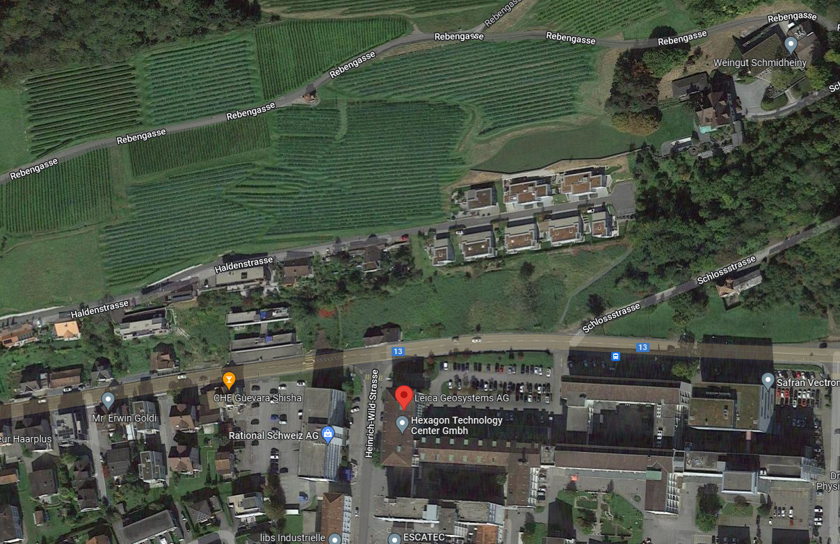
It was the same when I was in Heerbrugg…the targets are in the vineyard across the street
@geeoddmike I miss my dear friend and fellow Marine Brother Charlie Glover. I was bzo ing his M-1 and other toys not to long before he left us. Great guy and smart . He didn??t need a calculator to perform half of what I need one for.
yes many folks shooting a distance between two points is not enough to accurately check the edm you need distances at different lenths so the varying edm waves and such can be checked between multiple different types of edm??s The one wild we did accurately measured within specs at the shortest and longest lines but inaccurately measured to the middle marks . It has been so long ago now I believe it was measuring long on the middle marks out of specs

@olemanriver Are you talking about Charlie Glover of NGS? If so Mr. Glover was never a U.S.Marine. Where did you come up with this information?
JOHN NOLTON, USMC 1961 to 1970
Got the dc file uploaded from the field and processed the data…he mixed prisms (which I didn’t want him to do but didn’t specifically tell him not to). Most of the shots were to a Wild GPH1P (-34), a few were to a Trimble Monitoring prism (-40).
When I ran it with both prisms, I got a scale error of -1.29 ppm, and a constant error of +0.0015 m.
When I ran it with only the Wild prisms, I got a scale error of -0.65 ppm, and a constant error of +0.0003 m, which is within the specs of the instrument (1 ppm ?ñ 1 ppm). When he gets back to the office I am going to compare the two prisms on the baseline between my pedestals (~135 meters) to see if the offset of the Trimble prism is correct (assuming the -34 is correct based on the above).
One thing that is critical when going to a CBL is getting the temperature right (the instrument has an onboard pressure sensor, which I have verified is accurate). An error of 1?øC corresponds to 1 ppm.

Log in to reply.