
Cool find
I went to the field Friday looking for some corners and setting the monuments for my client’s boundary corners.
There was a WC set for a section corner that falls very close to the north bank of the river. The section corner falls in the river and it was witnessed in four directions. For three of the witness corners the river has moved and taken them out, only the WC on the north side of the river stands a slight chance of still remaining. It being the last one that I’ve looked for I was optimistic since my calcs fit just out of the water.
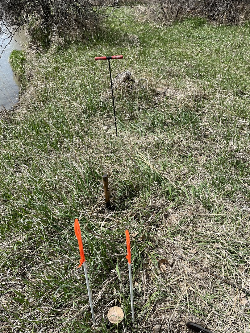
Within 5′ of my calc on the bank of the river, I found this.
The notes called for a set stone, 2′ east of a mound, 8′ east of a pit.
The pit and mound were clearly there, the stone was missing, no amount of digging and probing turned it up. I tried in the mound, west of the mound, north and south of the mound and finally gave up and set my corner on the east side of the mound as described in the notes.
After setting the cap and taking the pictures I dug and dug all around it probed and probed, the stone must have been removed, there is little rock in the area so maybe someone used it for fencing, hard to say what happened.
The pit measured right at the 8′ call, the cap bears N89dE from the pit.
This is a pic with the cap, hammer on the mound and probe in the pit:
The river is very close to the point, it’s hard to believe that it didn’t move to north since the bank is high there and eroding, but it’s still where it was 120 years ago!!

Log in to reply.