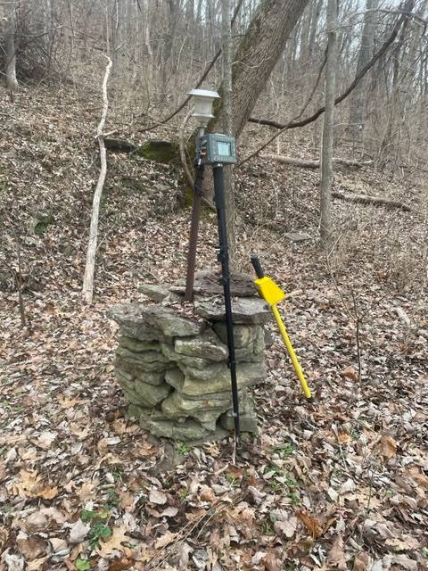
It was definitely not put up by a surveyor. That is just not done around here. The landowner had put a t-post at each of his back corners with matching solar lights (could even find the corners in the dark) but had only gotten around to building one of the rock pillars so far. Pedigree of monuments is as rare as hens teeth in this non-recording state. I am working off of three recorded plats that mostly fit together. North-South I’ve got about 11 feet of slop and East-West (direction of slip) there is about 7′. An old timer said the original subdivider wanted to make sure everybody got at least what was coming to them so when he sold off 100′, he would measure off 110′ to be sure. That does not seem to be the case, but an interesting bit of parole evidence. By my early resolution of the boundary, I believe the rock pillar is off calculated corners by about 7′ East-West. It is not my corner and my retracement plat will not get recorded so I hope the next guy that finds my caps will call and ask for my plat. There were about 10 more monuments than I expected to find in this area (I found 11). Holding any one or two would give vastly different property line locations but that is how it often goes.
This property is on a road formerly known as Fish Trap Road because when the river would flood, fish would be in the ditches on the uphill side of the road and after it receded, they were trapped by the road. The area is very close to Big Bone Lick which was a historically important area for getting salt and early maps showed many roads. Now it has been bypassed by progress and most of those roads have all but disappeared leaving access to some of the parcels questionable.