
Grid System for Progressive Maps in the United States Special Publication No. 59
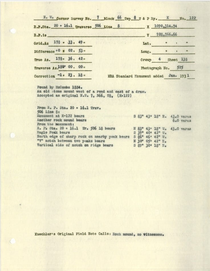
I am retracing W.J. Powell’s 1930-31 retracement of Paul McComb’s 1883 retracement of Jacob Kuechler’s 1878-79 survey of the Texas & Pacific Railway Company’s 80 mile reservation in West Texas. Powell had his principal field surveyor supplement the original corners with a pipe and cap. He also tied his survey work to triangulation stations in the vicinity. Datasheets were created for each monument and a coordinate value was assigned. I finally found in his report on the survey that the coordinates are not NAD27 but are based on an earlier coordinate system established William Bowie, Chief of Geodesy of the USC&GS and formerly of the U.S. Army. (Powell used the title of Major, so he might have learned the coordinate system from military service).
Powell refers to “Grid System for Progressive Maps in the United States” Special Publication No. 59, Zone E in his survey report. I was previously unaware of this coordinate system and I’m guessing CORPSCON can’t convert it. ????
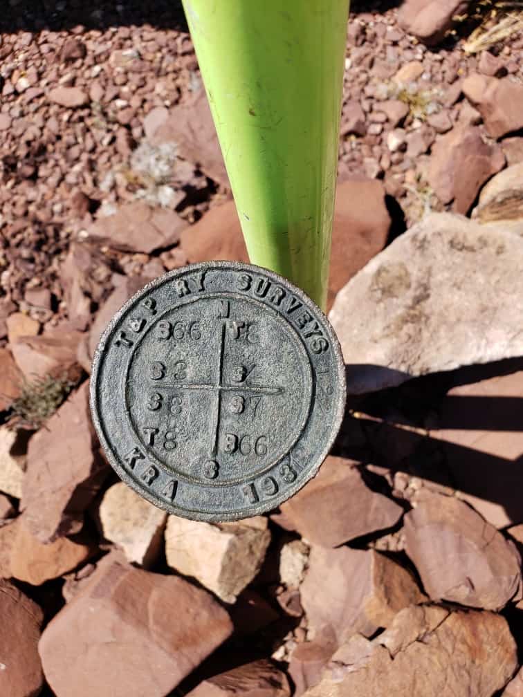
I did find Kuechler’s monument 122, a stone mound perpetuated with cap and pipe. I think I have enough other corners to translate the coordinates.
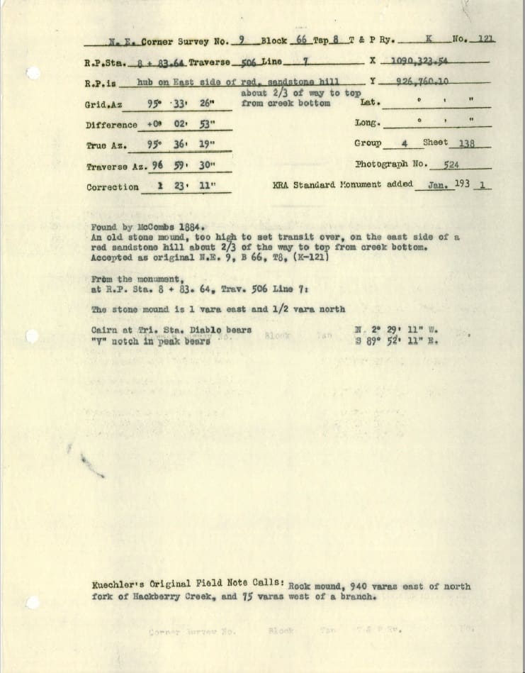
I had computed search coordinates for the section corner 1 mile south, but I stopped looking for it when the angle of terrain exceeded my ambition. I assumed that no corner was set here as Kuechler’s modus operandi was to run along the lowlands and valleys and stop setting corners when he hit rough terrain.
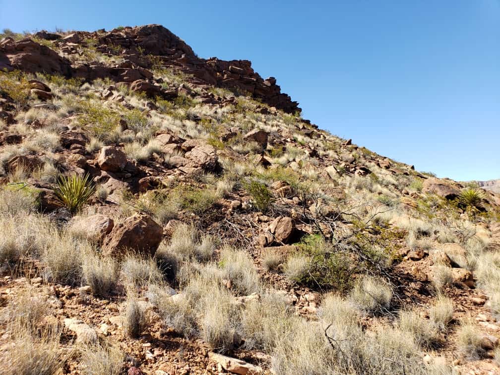
It turns out there is a rock mound up the hill “2/3 of the way to the top from creek bottom”. Thankfully my company employs some hearty, younger men who can probably scramble up to take a shot on it.
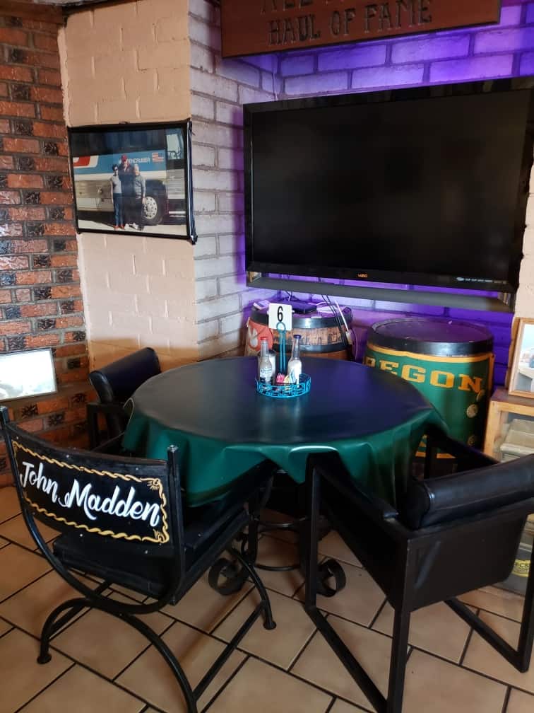
I did get a chance to eat at Chuy’s in Van Horn, which was a favorite of John Madden’s whenever he was riding through on his bus. I had the No. 21 John Madden plate. Very good but more than I could finish.


Log in to reply.