
Looking for some help/criticism on my plan for surveying some forest
Hi, I’m looking for some comments on a plan I have before I purchase some equipment. Still learning the basics, so forgive my ignorance.
I want to generate a topographic map of an estimated 20 acre watershed for pond construction calculations, and for fun. There are no available existing topo maps of the area. There happens to be a TruPulse 200 for sale locally for only $200, and I also plan to buy a decent compass (looking at a $80 suunto, but suggestions very welcome). The property survey indicates elevation from sea level of one of the corner metal posts so I would start there. I’ve been using QGIS to map fictional coordinate and elevation change data, like the data I plan to obtain using the below plan, in order to get comfortable with the software and practice generating topo maps from scattered points.
The plan:
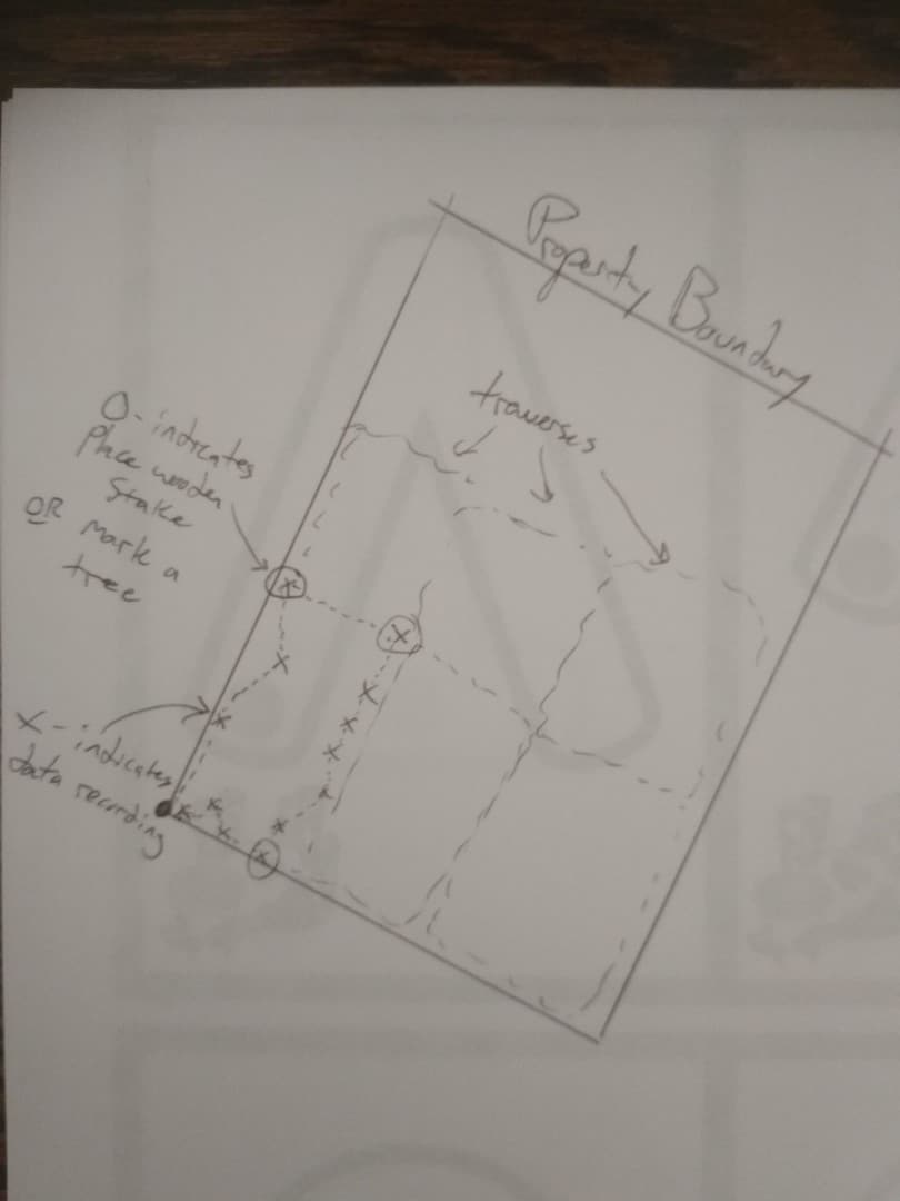
I would use a helper wearing an indicator on them the same height as my eye level. Using the compass, I would have them proceed roughly along the bearing indicated by the property line, in my field of view, for 20 or 30 meters, if on relatively flat ground. The TruPulse would then be used to find the horizontal distance and elevation change between me and them. I would input that into my spreadsheet on my tablet (which produces XYZ coordinate data relative to start point). I would then walk to where they were standing and they would proceed again along roughly the same azimuth. As it varies in order to go around dense vegetation, I would indicate the new azimuth. The spreadsheet I have accounts for this when generating the XYZ points. When on very undulating ground, maybe only 10 yard progressions would be made in order to get better resolution of the topography – It’s nice to see where seasonal creeks run. After maybe 50 or 100 yards of this, I would take a 90 degree turn, proceed back the way we came, a final 90 deg turn, and return to the start point, to complete a closed rectangular traverse. This would allow obvious mistakes to present themselves when the data is entered in and the first and last points are outside a reasonable margin of error (they should be the same). I would continue these rectangular closed traverses, maybe staking out the corners or marking a tree at the corners so I know where to proceed from for the next traverse.Here is a picture of what ‘The plan’ could look like:
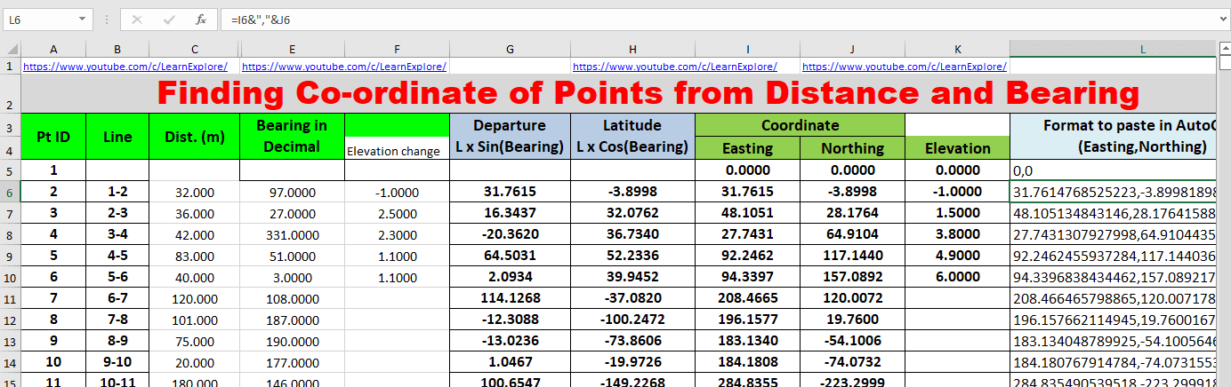
Here’s a screenshot of the excel sheet that takes the relative measurements and produces actual XYZ coords. My starting lat/lon removed for privacy.
Is it better to go in long strips? Am I way off thinking my compass will provide an accurate enough azimuth (it says +/- 0.5 deg…)? Is there something blatantly obvious I’m missing here? Thanks for any advice.


Log in to reply.