Monuments were set before we got to the site by another company. We were given coordinates (SPC and Local) on them and pretty much asked to check everything and set some intermediate points to build off in the future. Only two were inter visible so I occupied one, back sighted the second and saw a .0.04 distance error. I then measured that same point and held the new coordinate for my traverse. After that I measured rounds (3 sets, each set taking 10 observations direct and reverse).
On these types of projects line of sight becomes an issue constantly so we resect a lot. Knowing this I did kind of a worst case scenario after running the traverse and resected between two points from a poor angle and checked points that were in my traverse but intentionally left out of the resection. Everything checked in the thousandths. Tomorrow will be the level loop around site.
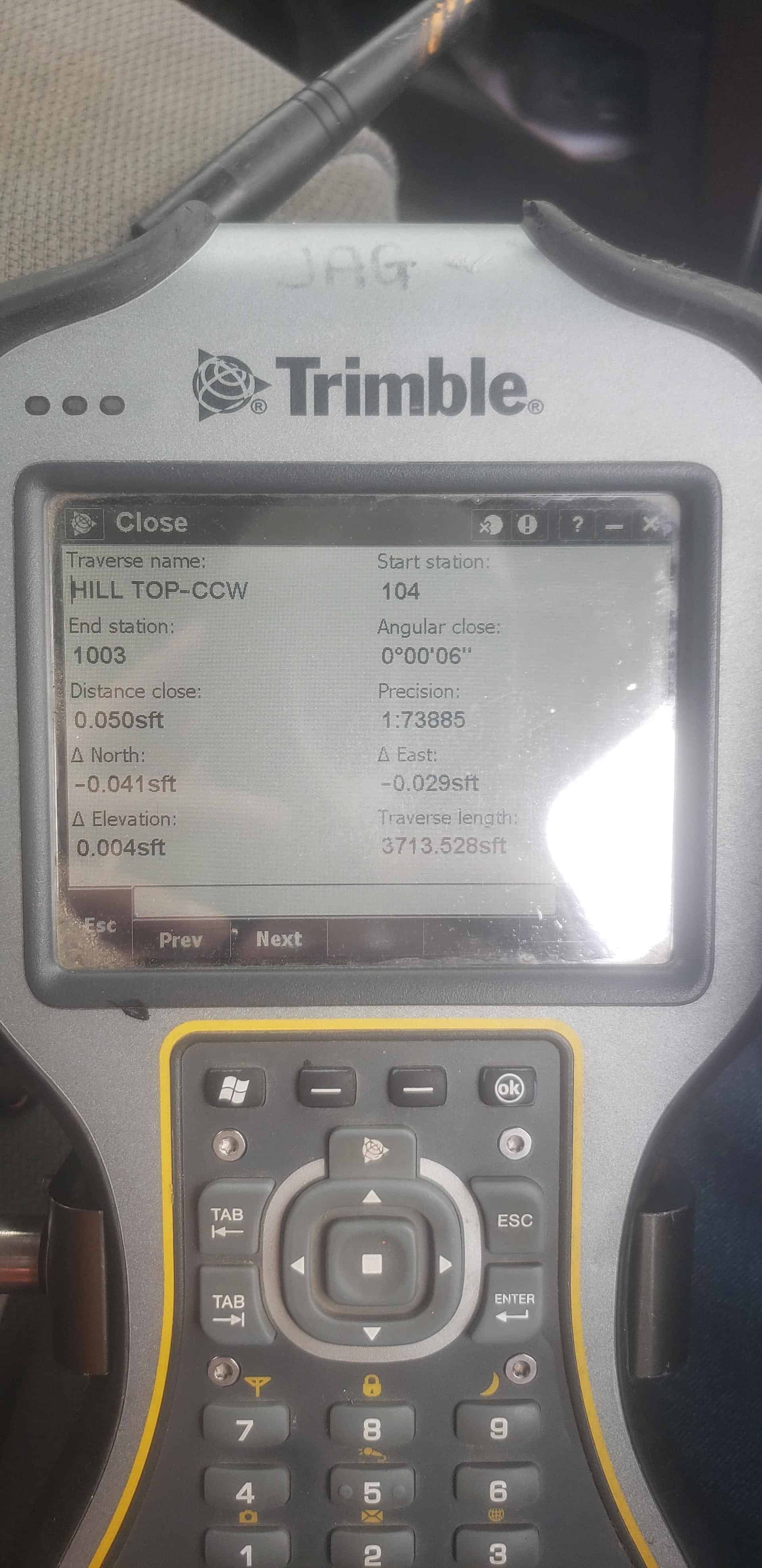
I was debating whether to run the traverse in the opposite direction and then average the coordinates but I’m not sure if we will even have the time to do that.
Side note: the day before we ran it I ran the adjustments on my total station l (compensator calibration etc.) And then adjusted my back sight kits to match my total station as close as possible making sure the bubbles and optical plummet all matched.